


Updated 30 October 2026.
Odesa is easy to explore by car: park once to see the centre on foot, while the estuaries, the catacombs and Akkerman Fortress are 1–1.5 hours’ drive away. Below are 15 beautiful places in and around Odesa, with coordinates, routes and safety rules for 2026.
If you need a classic list of sights for walking, see also our guide “Odesa: what to see and where to go”.
| Place | From the centre | Time needed | Coordinates |
|---|---|---|---|
| Deribasivska Street, Passage and City Garden | centre | 1–1.5 h | 46.48431, 30.73574 |
| Opera and Ballet Theatre | centre | an evening | 46.48543, 30.74117 |
| Prymorskyi Boulevard and Potemkin Stairs | centre | 40 min | 46.48850, 30.74188 |
| Vorontsov Colonnade and Mother-in-law Bridge | centre | 30–40 min | 46.49008, 30.73876 |
| The Wall House | centre | 15 min | 46.48870, 30.73825 |
| Transfiguration Cathedral | centre | 30 min | 46.48316, 30.73097 |
| Devolanivskyi Descent | 1 km | 30–40 min | 46.48098, 30.74579 |
| Shevchenko Park | 2 km | 1–1.5 h | 46.47898, 30.75627 |
| ONU Botanical Garden | 7.5 km | 1.5–2 h | 46.44194, 30.76889 |
| Kuialnyk Estuary | 10 km | 1–2 h | 46.56105, 30.72791 |
| Nerubaiske catacombs | 15 km | 1.5 h | 46.53788, 30.62775 |
| Hadzhibey Estuary | 39 km | 1–2 h | 46.71578, 30.51774 |
| Akkerman Fortress | ~96 km | half a day | 46.20059, 30.35070 |
| Shabo | ~103 km | 2–3 h | 46.14294, 30.37332 |
| Vylkove | ~205 km | 1–2 days | 45.39836, 29.59036 |
Tap the coordinates to open the location in Google Maps, where you can easily plan a route.
Historic centre: one car park, a dozen locations
Central sights are 5–15 minutes’ walk apart, so leave the car at a municipal car park (pay by QR code) and walk. There is no underground car park beneath the Opera House: the theatre’s five underground levels serve as a shelter.
1. Deribasivska Street, the Passage and the City Garden
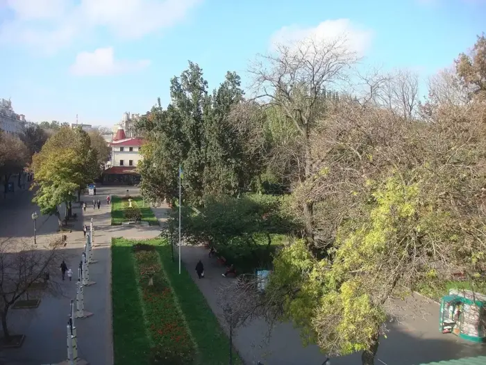
Deribasivska Street, Passage and City Garden. Photo: HOBOPOCC / Wikimedia Commons, CC BY-SA 3.0
Pedestrian Deribasivska Street is the main street of Odesa. At its start stands the monument to José de Ribas, at No. 33 is the Passage with its richly decorated gallery, and nearby is the City Garden with a fountain and a summer stage.
Coordinates: 46.48431, 30.73574. Time: 1–1.5 hours.
2. Odesa National Academic Opera and Ballet Theatre
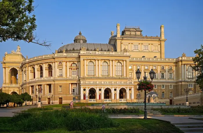
Opera and Ballet Theatre. Photo: Posterrr / Wikimedia Commons, CC BY-SA 4.0
The theatre, designed by the Viennese architects Fellner and Helmer, opened in 1887 and is still open in 2026: ticket numbers are limited by the shelter’s capacity (about 1,500 people), and during an air-raid alert a performance may continue in the underground hall.
Coordinates: 46.48543, 30.74117.
3. Prymorskyi Boulevard, the Potemkin Stairs and the Duke
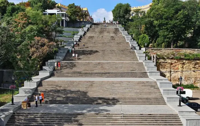
Prymorskyi Boulevard and Potemkin Stairs. Photo: Oleksandr Malyon / Wikimedia Commons, CC BY-SA 4.0
From Deribasivska Street to Prymorskyi Boulevard is a 5–7 minute walk. The boulevard reopened to pedestrians in October 2023, and the Potemkin Stairs, built in 1837–1841 to a design by Francesco Boffo, on 20 April 2024. The monument to the Duc de Richelieu stands on the upper landing.
Coordinates: 46.48850, 30.74188.
4. Vorontsov Palace, the colonnade and the Mother-in-law Bridge
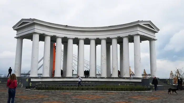
Vorontsov Colonnade and Mother-in-law Bridge. Photo: Сіліч Марія / Wikimedia Commons, CC BY-SA 4.0
The white colonnade by Vorontsov Palace is one of the city’s finest viewpoints, overlooking the port and the Vorontsov Lighthouse. The lighthouse itself is inside the working port, which is closed to the public, so you can only admire it from the shore. Nearby is the pedestrian Mother-in-law Bridge. The palace was damaged in 2022; the colonnade is open for walks.
Coordinates: 46.49008, 30.73876. Time: 30–40 minutes.
5. The Wall House in Vorontsov Lane
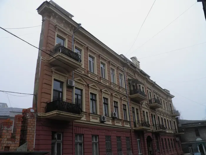
The Wall House. Photo: Vimoculars / Wikimedia Commons, CC BY-SA 3.0
The apartment building at 4 Vorontsov Lane, built from 1890, looks like a flat wall with no depth from a certain angle. The effect comes from the triangular shape of the plot and a tall corner façade next to a much lower neighbouring building. The popular story that there “wasn’t enough money” for the fourth wall is just an urban legend.
Coordinates: 46.48870, 30.73825.
6. Transfiguration Cathedral
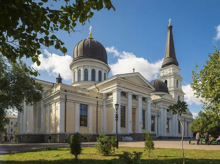
Transfiguration Cathedral. Photo: Konstantin Brizhnichenko / Wikimedia Commons, CC BY-SA 4.0
The cathedral on Cathedral Square, destroyed in 1936 and rebuilt in the early 2000s, was damaged by a missile strike on the night of 23 July 2023. The main restoration work was completed by October 2024, and the cathedral is open to visitors again.
Coordinates: 46.48316, 30.73097.
Atmospheric places off the tourist trail
7. Devolanivskyi Descent and its three bridges
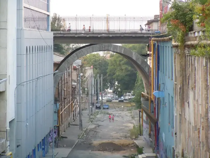
Devolanivskyi Descent. Photo: Yuriy Kvach / Wikimedia Commons, CC BY-SA 3.0
The descent from the centre to the port is crossed by three old bridges: Stroganov Bridge on Hretska Street, Kotzebue Bridge on Nina Strokata Street and Novikov Bridge on Sviatoslav Karavanskyi Street.
Coordinates: 46.48098, 30.74579. Tip: the best angle is from below, on the descent itself, looking up at the arch of Stroganov Bridge.
8. Shevchenko Park
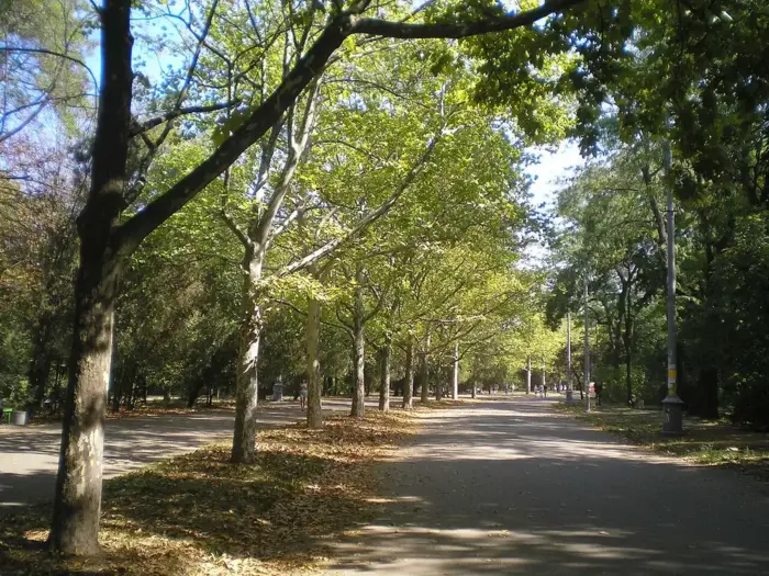
Shevchenko Park. Photo: Yuriy Kvach / Wikimedia Commons, CC BY-SA 3.0
One of the largest parks in Odesa, with shady avenues and a monument to Taras Shevchenko. The inner part of the park is open for walks; the slopes down to the sea are part of the coastal strip, where restrictions currently apply, so do not go down to the water.
Coordinates: 46.47898, 30.75627. Time: 1–1.5 hours.
9. Botanical Garden of Mechnikov National University
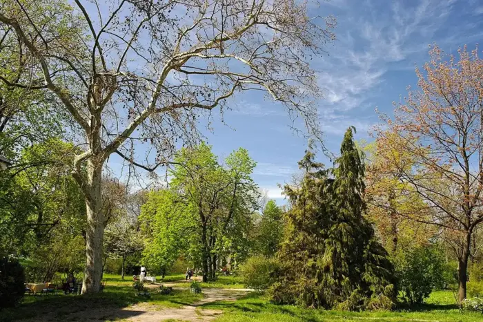
ONU Botanical Garden. Photo: Сергій Криниця (Haidamac) / Wikimedia Commons, CC BY-SA 4.0
The Botanical Garden of Odesa National University was founded in 1867. More than 3,000 plant species grow on its roughly 16 hectares. After a missile strike on 25 March 2024, the garden reopened to visitors. Entrances are at 48/50 and 87 Frantsuzkyi Boulevard.
Coordinates: 46.44194, 30.76889. Tip: check the opening hours on the university website before you go.
Near Odesa: estuaries and catacombs
10. Kuialnyk Estuary
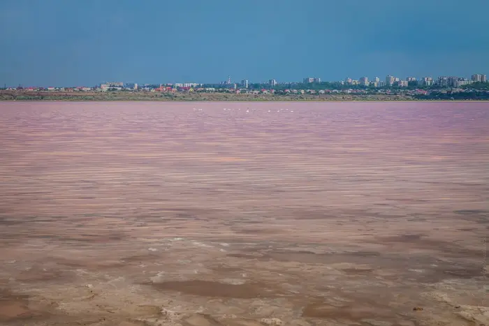
Kuialnyk Estuary. Photo: Vadim Tolbatov / Wikimedia Commons, CC BY-SA 4.0
This shallow salt estuary, about 28 km long, begins 10 km from the centre. It is known for its therapeutic mud and brine (the Kuialnyk resort has operated since 1834), and in the hot months the water sometimes turns pink, coloured by the microalga Dunaliella salina. The pink tint depends on salinity and weather, so you will not always see it.
Coordinates: 46.56105, 30.72791. Tip: wear closed shoes, as the shores are salty and slippery.
11. Catacombs in Nerubaiske
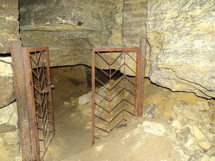
Nerubaiske catacombs. Photo: Adam Jones / Wikimedia Commons, CC BY-SA 2.0
In the village of Nerubaiske, 15 km from the centre, the Museum of Partisan Glory occupies old quarries: you can walk through part of the underground passages where partisans hid during the Second World War. Visits are guided only.
Coordinates: 46.53788, 30.62775. Tip: call ahead to check the schedule, as it may change in 2026.
12. Hadzhibey Estuary
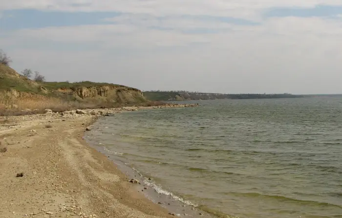
Hadzhibey Estuary. Photo: Igor Luzhanov / Wikimedia Commons, CC BY-SA 3.0
An estuary north-west of the city with high clay banks, it is a quiet spot for sunset photos.
Coordinates: 46.71578, 30.51774. From the centre: about 39 km.
Day trips
13. Akkerman Fortress in Bilhorod-Dnistrovskyi
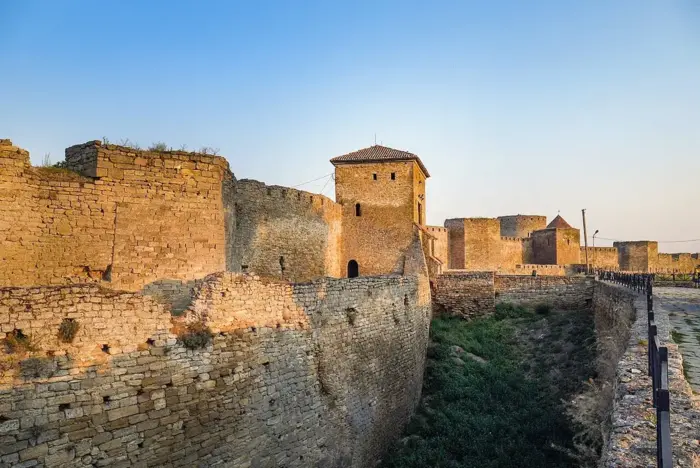
Akkerman Fortress. Photo: Posterrr / Wikimedia Commons, CC BY-SA 4.0
One of the largest fortresses in Ukraine, on the shore of the Dniester Estuary: about 26 of its 34 towers survive, and the walls run for roughly 2.5 km. According to the official website, the fortress is open to visitors; an adult ticket costs UAH 120.
Coordinates: 46.20059, 30.35070. Route: the bridge in Zatoka was damaged on 1 August 2026 and repairs are scheduled until 31 December, so take the M-15 highway via Mayaky, about 96 km.
14. Shabo Wine Culture Centre
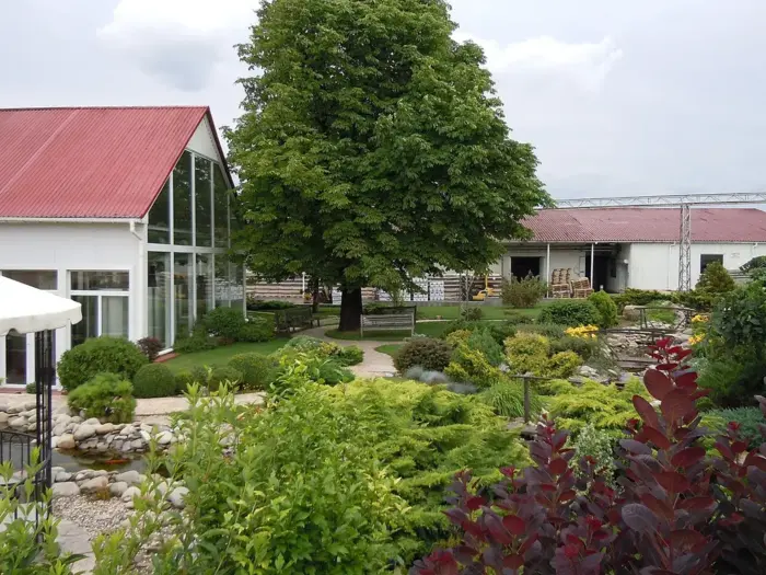
Shabo. Photo: Yuriy Kvach / Wikimedia Commons, CC BY-SA 3.0
In the village of Shabo, 7 km from the fortress, the wine culture centre has a museum, tasting rooms and, according to the producer, 200-year-old Swiss cellars. Tours are paid; prices and schedules are on the centre’s website.
Coordinates: 46.14294, 30.37332. Tip: combine it with the fortress in one trip, and have a sober driver take the wheel after the tasting.
15. Vylkove, the “Ukrainian Venice”
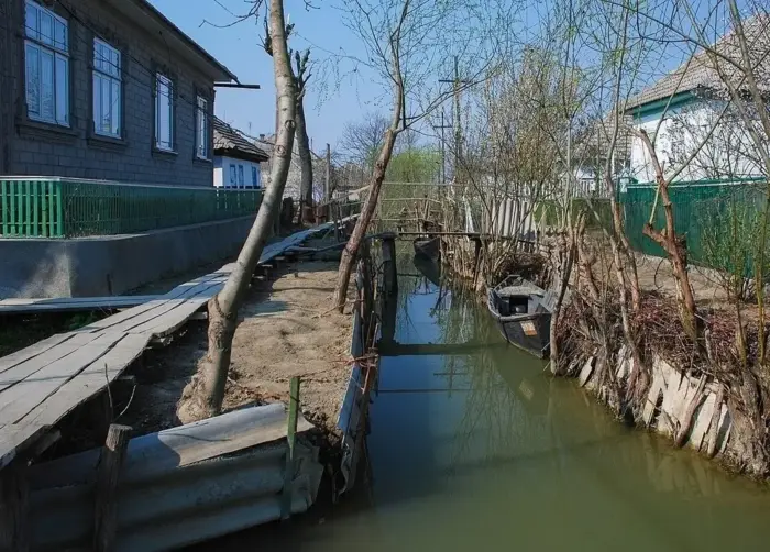
Vylkove. Photo: Rbrechko / Wikimedia Commons, CC BY-SA 4.0
A small town in the Danube Delta, ~205 km from Odesa, where canals called yeryky replace some of the streets, lined with wooden footbridges and local fishermen’s boats. Here you can arrange a boat trip through the delta.
Coordinates: 45.39836, 29.59036. ⚠️ Safety: Izmail district was repeatedly attacked by drones in 2025–2026, and bridges along the route are damaged. Plan an overnight trip, only when the situation is calm, and follow updates from the Odesa Regional Military Administration.

Hyundai Tucson from the BLS fleet
Ready-made routes by car
Route 1. “The centre in a day” (one car park, on foot): Opera House → Deribasivska Street, the Passage and the City Garden → Transfiguration Cathedral → the Wall House → Vorontsov Colonnade and the Mother-in-law Bridge → Prymorskyi Boulevard and the Potemkin Stairs.
Route 2. “Estuaries and catacombs” (half a day, ~90 km): Kuialnyk Estuary → catacombs in Nerubaiske → sunset at Hadzhibey Estuary.
Route 3. “Fortress and wine” (a full day, ~200 km return via Mayaky): Akkerman Fortress → lunch in Bilhorod-Dnistrovskyi → Shabo Wine Culture Centre. For more trip ideas in the region, see our selection of interesting places in the Odesa region.
Safety when travelling in Odesa in 2026
- Coast. Since 5 October 2026, order No. 54/31 of the head of the Odesa Regional Military Administration and the command of the Odesa OTU has banned civilians from beaches and the coastal protection strip.
- Air-raid alerts. Install an alert app and find shelters along your route in advance.
- Photos and video. Do not film the port, bridges, military or infrastructure facilities.
- Bridges and highways. Before heading to the south of the region, check the condition of the bridges in Zatoka and Mayaky.
Frequently asked questions
Where to go in Odesa by car?
In the city, drive to the university botanical garden and Shevchenko Park; the centre is easier to explore on foot. Within 10–40 km are the Kuialnyk and Hadzhibey estuaries and the catacombs in Nerubaiske; for a full day, Akkerman Fortress and Shabo.
What are the most beautiful places in Odesa for photos?
Vorontsov Colonnade, the Potemkin Stairs, the Opera House in the evening, Stroganov Bridge over Devolanivskyi Descent and the pink Kuialnyk Estuary.
Can you go to the beach in Odesa now?
Since 5 October 2026, beaches and the coastal strip have been closed to civilians. Follow decisions by the Odesa Regional Military Administration: during the swimming season, beaches are opened by a separate order.
Where to go from Odesa for a day trip?
To Akkerman Fortress and the Shabo wine centre (about 96–103 km via Mayaky) or to the estuaries near the city. Vylkove is best planned as an overnight trip and only when the situation is calm.
Conclusion
Odesa combines the architecture of its centre with estuaries and historic sites an hour or two away. To avoid depending on taxis and bus timetables, it is convenient to rent a car in Odesa and see both the city and Akkerman Fortress over a weekend.